PATH Riders Council: Building a Model for Transit Agency & Customer Collaboration
I helped establish, and led the 14-person customer advisory board for the transit system connecting New York and New Jersey.

I helped establish, and led the 14-person customer advisory board for the transit system connecting New York and New Jersey.

Extending PATH would finally offer a one-seat ride to a major New York-area airport, and strengthen equity for underserved communities.

How cities can partner with the private sector to subsidize public transit in lieu of private shuttles.

In 2013, the Metropolitan Transportation Authority, New Jersey Transit, and Port Authority of New York & New Jersey released a Regional Transit Diagram–dubbed the first of its kind for the region–to help fans and media visiting for Super Bowl XLVIII in early 2014. The diagram was designed by Yoshiki Waterhouse of Vignelli Associates, in a…

Imagine stepping off your bus, ferry, or train at Hoboken Terminal and onto a new public plaza at Hudson Place. From spring to fall, you can shop at the downtown farmers’ market, and enjoy expanded outdoor seating at adjacent restaurants and bars. A pop-up holiday market brings cheer to the cold winter months. Year-round, Hoboken…

Transit systems like PATH and the New York City Subway need ongoing maintenance to maintain frequent and reliable service. Since both operate 24/7, work is often squeezed in during nights and weekends when passenger demand is lighter. But sometimes larger work periods are needed for major projects like the complete overhaul of a century-old signal…
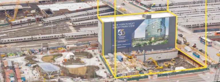
Published in The Wall Street Journal – June 9, 2016 The interplay between transit capacity and real-estate development is an important issue facing cities around the world. In the Wall Street Journal article PATH Strains Under Housing Boom, Port Authority Chairman John Degnan said that the agency planned to seek capital contributions from cities and…

A few weeks before the opening of the new World Trade Center Transportation Hub, PATH invited journalists and members of the PATH Riders Council for a behind-the-scenes tour. The new Transportation Hub is the fourth station to occupy the site. The first, built in 1909 as the Hudson & Manhattan Railroad’s Hudson Terminal, was replaced…
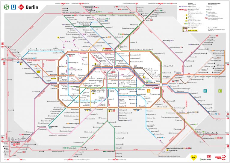
New York & New Jersey Subway Map shows how we can give people a comprehensive view of transit options in the NYC region. The map generated lively discussion on SubChat, a popular transit discussion board, and commenter AEM-7AC #901 noted that the official rail rapid transit map in Berlin displays services provided by two agencies….

Could Penn Station finally get a grand new entrance on Eighth Avenue? In December 2015, Charles V. Bagli reported in the New York Times that New York Governor Andrew Cuomo was considering ways to jumpstart the long-running project to overhaul Penn Station. Perhaps with an eye toward an announcement at the governor’s State of the State…
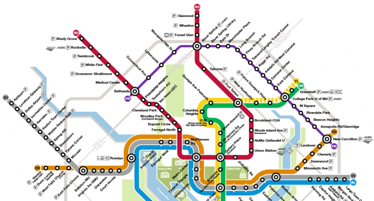
New York & New Jersey Subway Map shows how we can give people a comprehensive view of transit options in the NYC region. In the Washington DC metro area, a similar issue will soon be under consideration: whether to include the Maryland Purple Line on the Washington DC Metrorail Map. The Maryland Purple Line is…
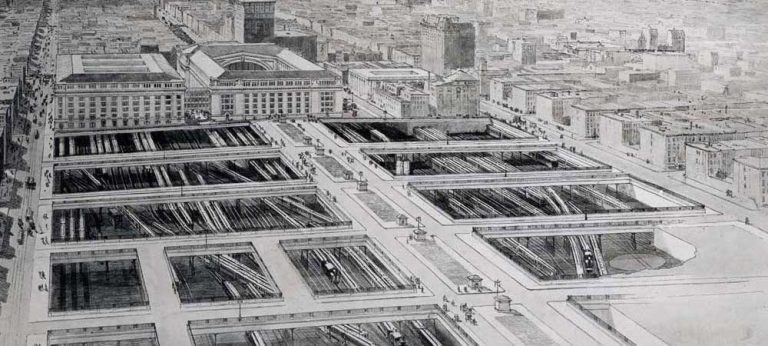
Transit hubs in the New York area have long been catalysts for the growth of their surrounding neighborhoods, and the shared economy of the NY & NJ urban core. Five terminals were constructed along the New Jersey shore of the Hudson River during the rail boom of the late 19th Century: Weehawken Terminal, Hoboken Terminal,…

Transit customers benefit when agencies collaborate to create comprehensive maps that display each other’s services. I published the New York & New Jersey Subway Map as a proof-of-concept to demonstrate how a single map could give people a comprehensive, harmonized view of the transit options available throughout the region. It is based on the design…
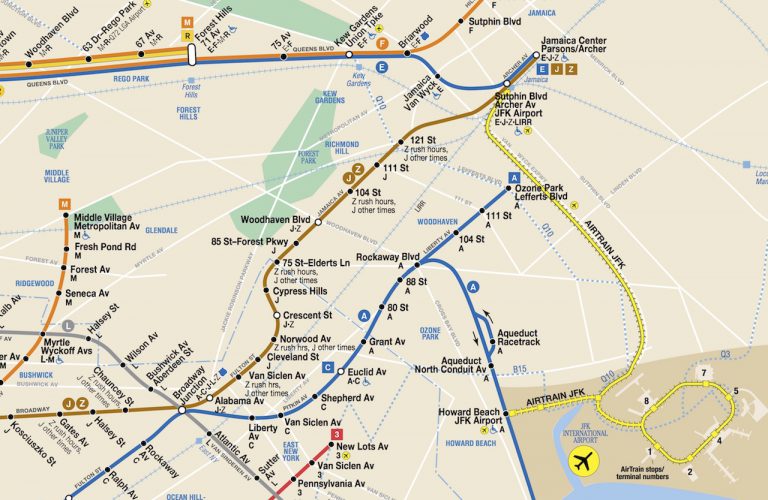
I published the New York & New Jersey Subway Map as a proof-of-concept to demonstrate how a single map could give people a comprehensive, harmonized view of the transit options available throughout the region. It is based on the design of the New York City Subway Map, one of the most recognizable transit wayfinding tools…