NYC Subway Map Displays AirTrain JFK; Sets Precedent for Including PATH
I published the New York & New Jersey Subway Map as a proof-of-concept to demonstrate how a single map could give people a comprehensive, harmonized view of the transit options available throughout the region. It is based on the design of the New York City Subway Map, one of the most recognizable transit wayfinding tools in the world, and incorporates subway, light rail, regional and intercity rail, and ferry services. Tens of thousands of riders now use the New York & New Jersey Subway Map to help them navigate the NYC metro area.
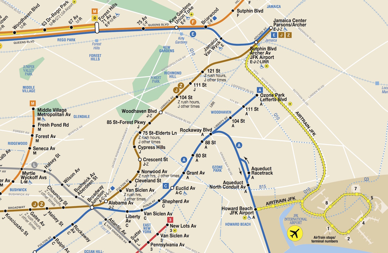
Subway maps in New York City have a long history of including connections between New York and New Jersey, and services run by other agencies that connect to the subway system. For example, the current New York City Subway map prominently displays AirTrain JFK, which connects terminals at John F. Kennedy International Airport with the A Train at Howard Beach, and the E, J, Z, and Long Island Rail Road at Jamaica. Like PATH, AirTrain JFK is operated by the Port Authority of New York and New Jersey. AirTrain is depicted using a visual style that is consistent with the rest of the Subway Map, and clearly indicates that a separate fare is required to use the AirTrain. This is an example of inter-agency cooperation that directly benefits transit customers.